Views of the Station
The Carnarvon Tracking Station covered a large area (approx 2.6 sq km) on Browns Range.
These photos give some idea of the scale of the station.
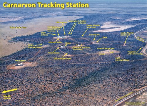
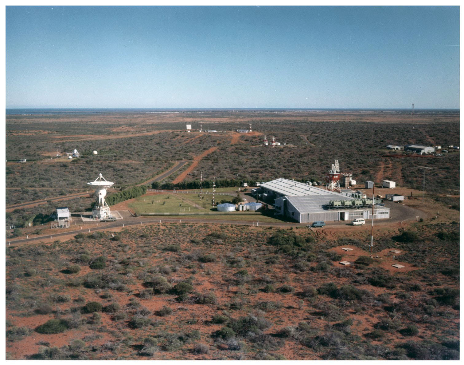
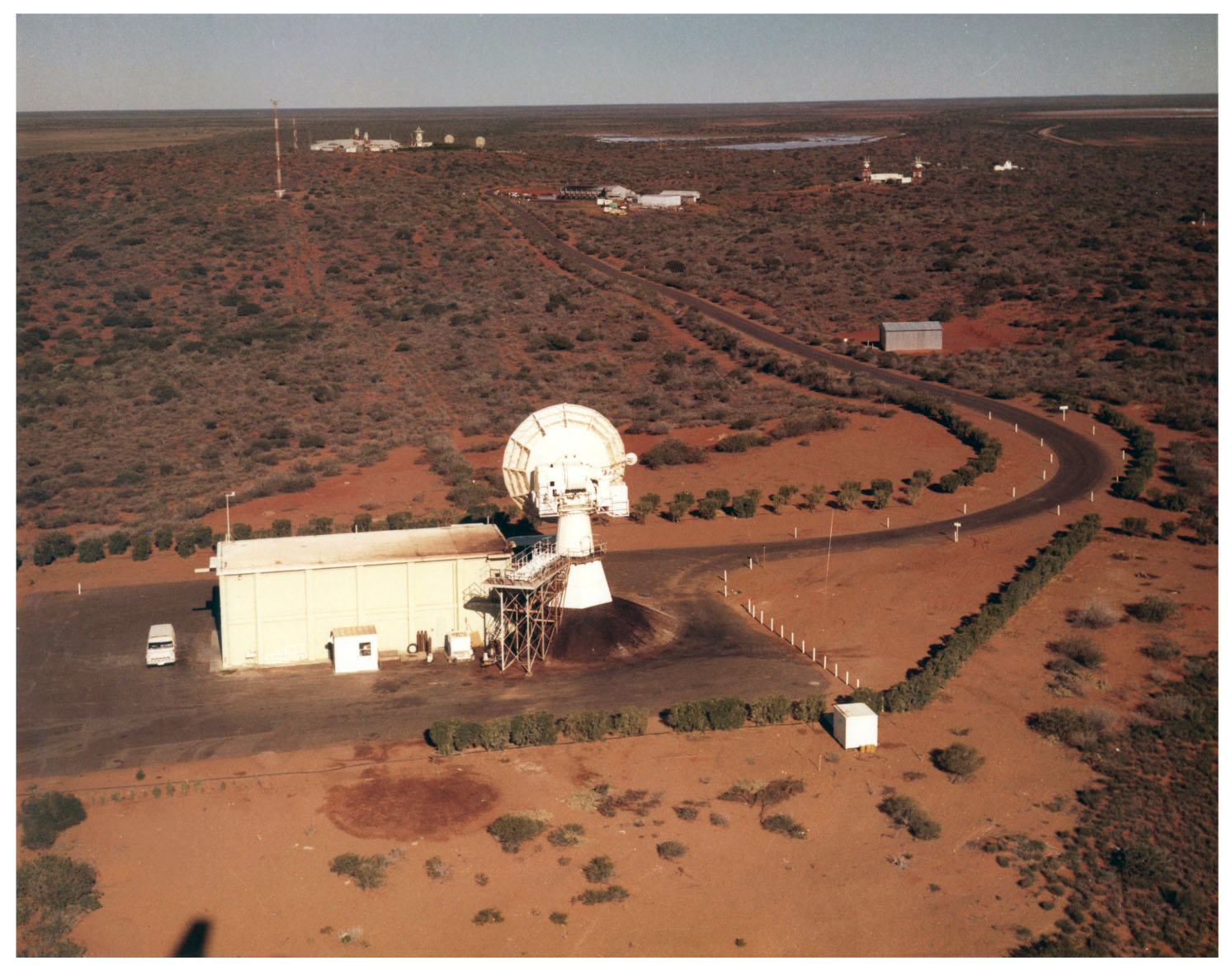
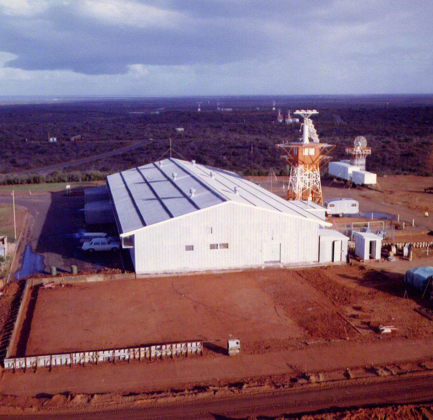
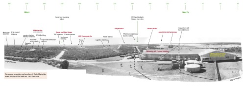
Carnarvon Tracking Station Panorama Click the image for a 6.6MB PDF panorama. It was assembled from several black and white photographs taken from the newly-completed 9 metre USB antenna in May 1966. The PDF file has two pages – the second one is the same, but without the annotations. The photographs were probably taken by a Department of Supply photographer. With thanks to Trevor Mosel, Stuart Wattison (who scanned them), Paul Dench and Terry Kierans. Panorama assembled and annotated by Colin Mackellar. Other photos from the same set may be seen here. |
Carnarvon Tracking Station from the air Hamish Lindsay took this photo covering the whole station in late 1966. Click the image to download a 5.7MB PDF file. The PDF file has two pages – the second one is the same, but without the annotations. |
Telemetry and Control Building from the air Hamish Lindsay took this photo in late 1966. Visible in this photo is the T&C Building – the new Apollo extension is at the top of the picture. To the right is the 9 metre USB antenna, and to right of it are the troppo-scatter antennae for communications to Geraldton. Scan: Colin Mackellar. |
The bitumen road from the junction near the SPAN facility, looking towards the T&C Building (left of centre) and the USB antenna (right). Photo: Tom Sheehan, 1971. |
![]() |
Here’s the field-of-view superimposed on a station map. And you can just make out the Turnpike sign arrowed in this 700kb detail from the panorama taken from the USB dish. |
![]() |
Aerial view Apollo configuration – looking South West. USB antenna on left, T&C Building on right. Large (340kb), Larger (1.7MB), Very large (6.1MB). A key is coming soon. Photo from the Tidbinbilla archives, scan by Glen Nagle. |
Aerial view Apollo configuration – looking South East. The FPQ-6 Radar. The T&C Building and USB antenna are visible in the distance, left of centre. Large (430kb), Larger (1.4MB), Very large (5.2MB). A key is coming soon. Photo from the Tidbinbilla archives, scan by Glen Nagle. |
The Carnarvon Tracking Station Telemetry and Control Building before Apollo. The foundations for the Apollo USB extension are laid out in the foreground. Taken just after sunrise, this photo shows the sea in the distance. The old Verlort radar, from Muchea is at right. Photo: Hamish Lindsay. |
Aerial view Apollo configuration. Note that the Apollo extension is now completed. Hamish Lindsay, who worked at Carnarvon before going to Honeysuckle Creek, writes Photo: Hamish Lindsay. How was it taken? Hamish writes, I was flying in a light aircraft without the door on (the pilot pulled fencing wire out of the hinges to remove the door!), and when he banked to turn all my gear would slide towards the open door. |